 thingiverse
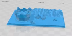
3D Print a Topographic Map
This is a somewhat simple method to 3D print a topographic map. It uses Google Drawings...
thingiverse
This is a somewhat simple method to 3D print a topographic map. It uses Google Drawings...
 thingiverse
Topographic map of the State of Ohio. Good for 3D printing or CNC.
 cgtrader
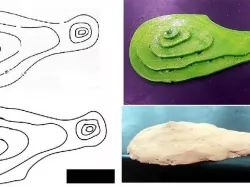
DescriptionHi, I am a CNC enthusiast and make files for carving. This file was created...
 cgtrader
Topographic map of Erangel from PUBG.
 cgtrader
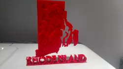
This is a geologically correct map of Rhode Island, showing varying elevations througho...
 thingiverse
3D topographic map created using DHM data from viewfinderpanoramas.org ...
 cults3d
This is a 3D model of a topographic map of Homestake. We print and distribute these in...
 thingiverse
This is a 3D model of a topographic map of Homestake. We print and distribute these in...
 cults3d
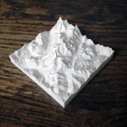
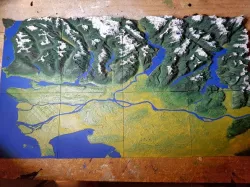
Highest peak in Europe, Mont Blanc is an Alpine myth for lovers of mountain heute. It i...
 cults3d
Highest peak in Europe, Mont Blanc is an Alpine myth for lovers of mountain heute. It i...
 thingiverse
These 3D maps showcase the topography and elevation changes across NSW. The topmost poi...
 thingiverse
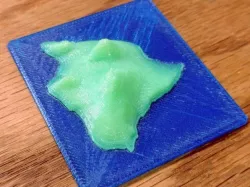
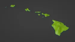
This is a 3D topographical map of the Big Island of Hawaii. Print with or without the o...
 myminifactory
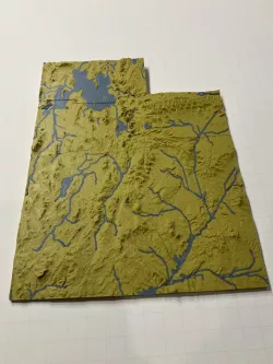
A 3D puzzle made with topographical map data of the Wasatch Front in Utah. In particula...
 prusaprinters
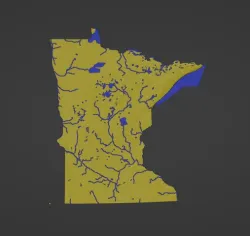
Minnesota, USA (MN) Topographic Relief Map with Rivers and Coastal WatersMinnesota, USA...
 prusaprinters
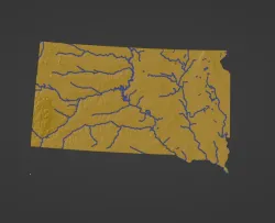
South Dakota, USA (SD) Topographic Relief Map with Rivers and Coastal WatersSouth Dakot...
 prusaprinters
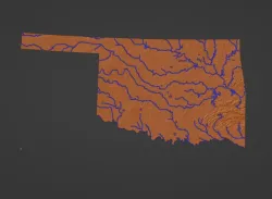
Oklahoma, USA (OK) Topographic Relief Map with Rivers and Coastal WatersOklahoma, USA m...
 prusaprinters
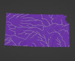
Kansas, USA (KS) Topographic Relief Map with Rivers and Coastal WatersKansas, USA mount...
 prusaprinters
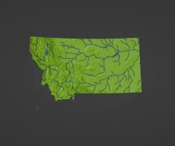
Montana, USA (MT) Topographic Relief Map with Rivers and Coastal WatersMontana, USA mou...
 prusaprinters
Hawaii, USA (HI) Southeastern Islands Coastline Topographic MapHawaii, USA Southeastern...
 myminifactory
Originally published here on Thingiverse. Designed using MATLAB R2016a making a "topog...
 thingiverse
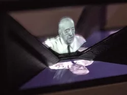
A few months ago I created a communication project that involved an holographic pyramid...
 thingiverse
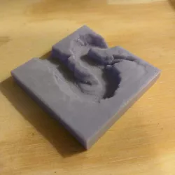
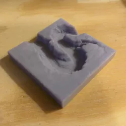
### Utah topographic map with major streams and lakes highlighted. ## This is an ol...
 thingiverse
*This is a remix. The Remix Source Files search does not seem to be working at this ti...
 cults3d
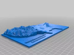
This is the famous Horseshoe Bend in Arizona. This is not an ordinary height map driven...
 thingiverse
This is the famous Horseshoe Bend in Arizona. This is not an ordinary height map driven...
 cults3d
Originally published here (https://www.thingiverse.com/thing:3407969). Designed using ...
 thingiverse
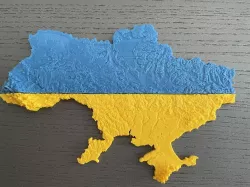
Due to recent events, I made this topographic map of the Ukraine. Scale of the model is...
 thingiverse
This is a 3D Topographical Map of Vancouver, British Columbia, Canada. Taken from Googl...
 prusaprinters
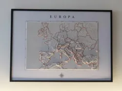
This 3D printable relief map of Europe is a detailed model that depicts the physical fe...
 thingiverse
This is a topographical map puzzle of the USA (minus Alaska and Hawaii). I thought it w...